Summary:
- Hurricane Francine is anticipated to make landfall on Wednesday, September 11th in Louisiana as category 1 hurricane.
- Currently, there are around 50 vessels near the path of the hurricane, most of them tankers.
- Ports in Louisiana and Texas are limiting operations due to storm advisories while Alabama is operating as normal while they continue to monitor.
- Risk of tornadoes is a concern particularly in Alabama. This could create major infrastructure damage and cause impacts to full truckload performance levels in particular.
Overview
On September 11, 2024, Hurricane Francine is expected to make landfall near New Orleans, Louisiana, as a Category 1 hurricane. Francine’s impact will include heavy rain, strong winds, and a dangerous storm surge. Major ports, including the Port of New Orleans and key Texas ports like Houston, are preparing for disruptions. Evacuations are underway in low-lying areas, and operations at ports and terminals have been paused as precautionary measures.
Francine is bringing sustained winds of 105 mph, along with a significant storm surge, especially in southeastern Louisiana. Coastal communities face mandatory evacuations, and millions in Louisiana and Texas are at risk of power outages and flooding.
In New Orleans, the potential for over 15 inches of rain could exacerbate flooding issues. As the storm moves inland, transportation networks and the energy infrastructure are expected to face significant strain.
Vessels in Vicinity
The map below shows vessels near the path of Hurricane Francine.
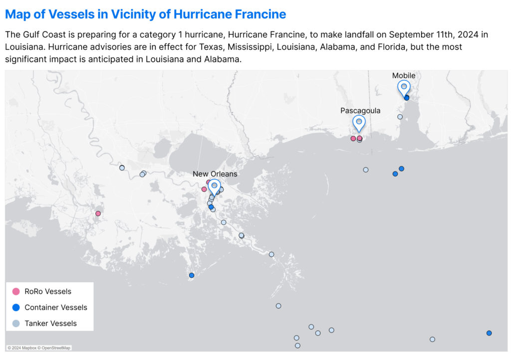
Around 50 vessels, particularly oil tankers, are located near the storm and may experience delays as they await safe entry into these major ports. Vessels at the ports may experience delays leaving as they wait for storm conditions to clear.
Much like Hurricane Beryl’s impact in Texas in early July, delays are anticipated for the U.S. oil and gas industry, as Gulf Coast refineries may need to shut down or delay operations. This comes during a critical period for imports of goods as the peak season approaches for U.S. retailers.
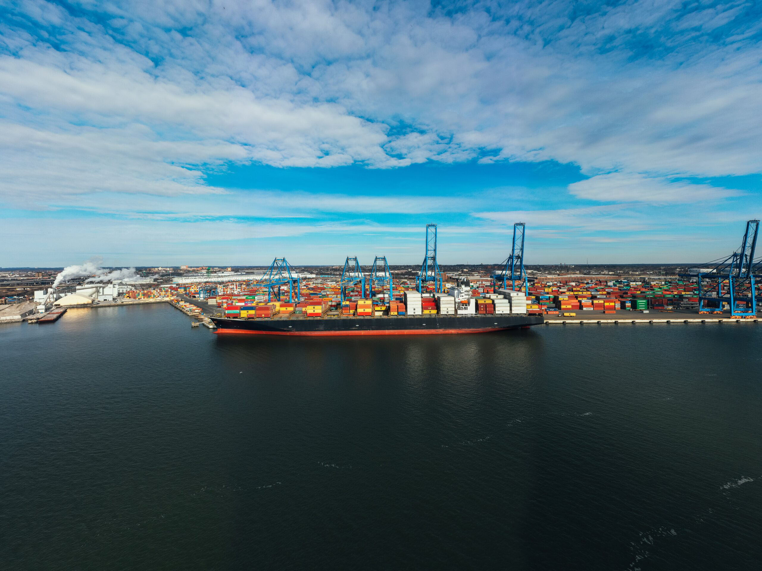
Ports Impacted
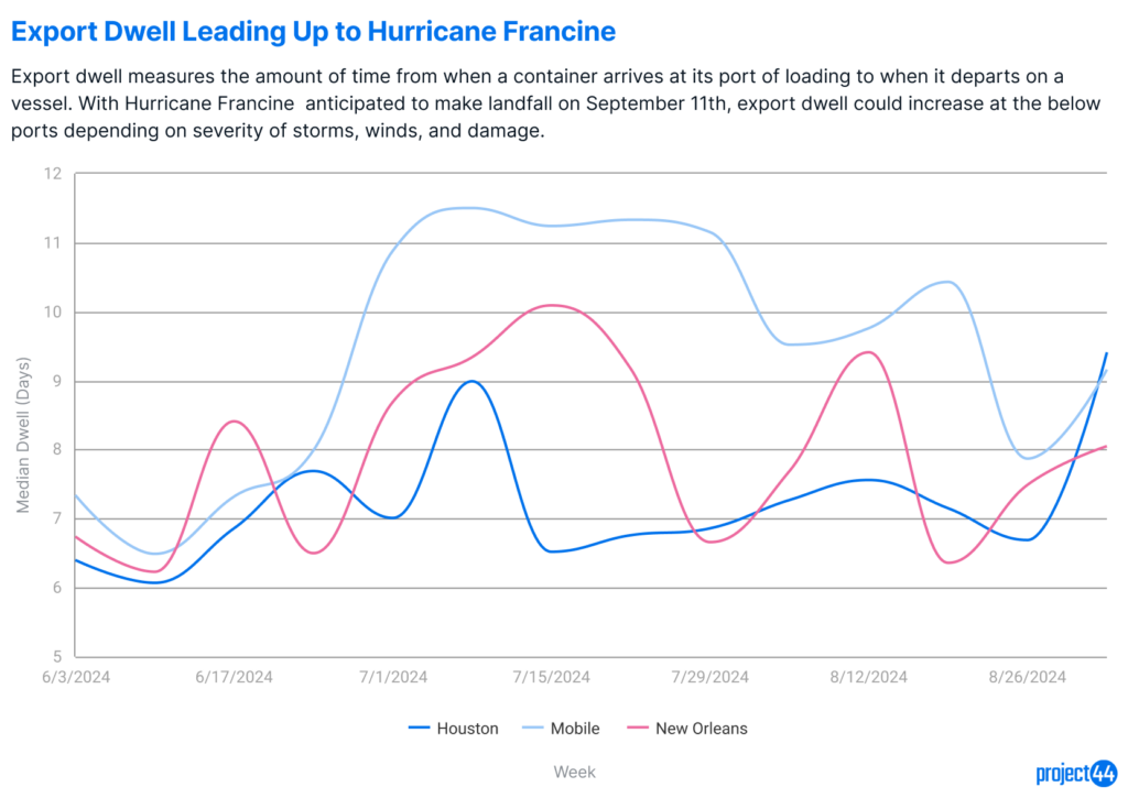
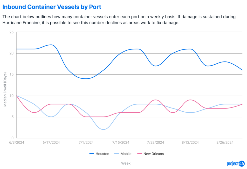
The Port of New Orleans is temporarily suspending operations. All cargo movement has been halted, and assessments will take place post-landfall to determine the extent of damage and reopening timelines. This is expected to cause backlogs in container processing as the port handles significant volumes for the southeastern U.S.
In Texas, ports such as Houston, Galveston, and Freeport are also preparing for impacts. Houston has implemented Port Condition X-RAY, signaling that gale-force winds, or winds from 39-54 miles per hour, are expected within 48 hours. The port remains open but with restricted operations, pending weather developments. Similar measures are in place at the Ports of Galveston and Freeport.
Alabama is under a tropical storm advisory and could also see similar impacts to their ports, though closures have not been announced at this time.
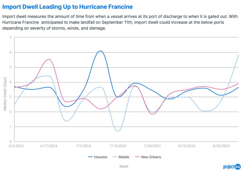
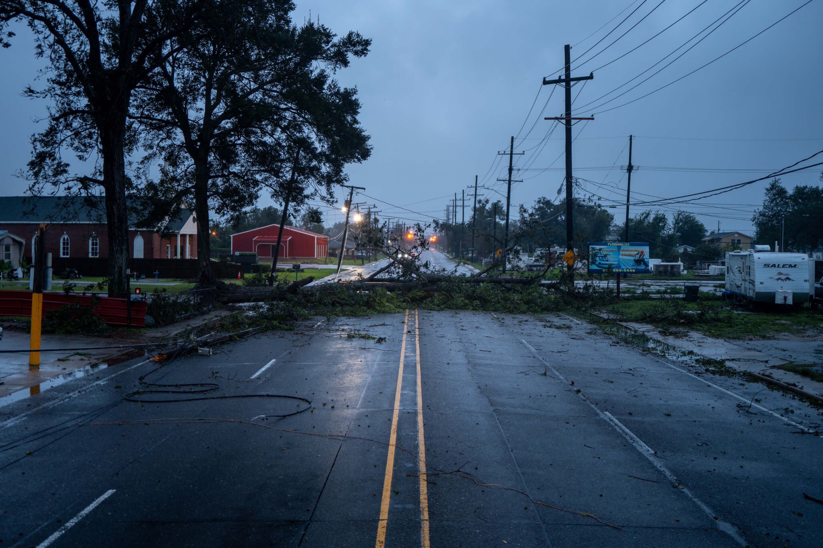
Truckload Impacts
Truckload shipments are susceptible to delays from hurricane-related roadblocks and flooding. There are also possible tornadoes related to the storms that could exacerbate these issues. Current on-time performance in these states is outlined below.
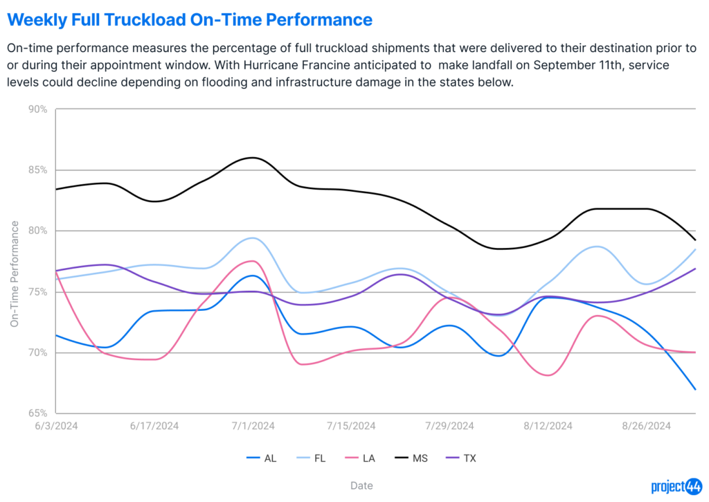
Early assessments indicate that truckload on-time performance may drop significantly in the days following landfall, similar to the 60% volume reduction seen during Hurricane Beryl.
Summary
Hurricane Francine threatens widespread disruption along the Gulf Coast, including power outages, port closures, and transportation delays. Key ports like New Orleans and Houston have paused or limited operations while Mobile continues normal operations. The hurricane could impact supply chains for industries ranging from energy to retail. Recovery efforts will depend on the storm’s path and the extent of damage to critical infrastructure.
Concern for Safety
While project44 has made it a priority to provide frequent updates on Hurricane Francine and its impact to the supply chain, the safety of all people impacted by the storm remains top of mind. They and their families are in our thoughts, and we urge people to follow local guidelines for safety in these times.